
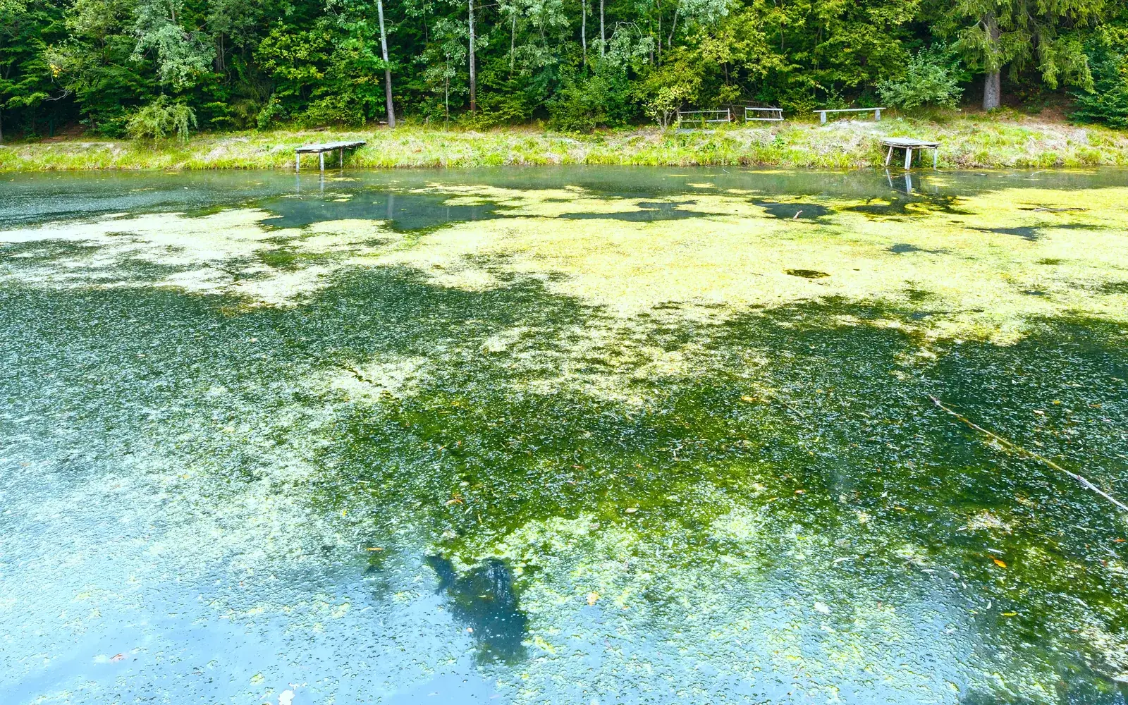
August on Long Island is the month the ponds turn. The water warms, the nutrients that ran off in June and July have had time to work, and the surface of a familiar pond goes the color of pea soup, or develops streaks that look like spilled paint.
That is a cyanobacteria bloom, commonly called blue-green algae, and the state tracks it. As of Tuesday, the New York State Department of Environmental Conservation's harmful algal bloom system carried 121 current reports statewide, spread across 29 of New York's 62 counties.
Eighteen of them are in Suffolk County. Nassau County has none.
Which waters
The 18 active Suffolk reports cover ten distinct waterbodies, several of them reported more than once as conditions were re-confirmed on later dates. All are listed with a status of Confirmed.
Agawam Lake in Southampton Village carries two reports, from July 21 and July 28, both describing a widespread or lakewide bloom. Wainscott Pond carries two, from July 22 and July 28, also widespread or lakewide. Mecox Bay carries five separate reports, three from July 21 and two from July 28. Town Pond and a waterbody listed as Town of Babylon Pond each carry a July 27 report describing a widespread or lakewide bloom. Maratooka Lake in Mattituck carries a widespread report from July 27. Laurel Lake carries one from July 23.
Three more entries are logged as unnamed waters: one in East Hampton, reported twice on July 23 as widespread or lakewide, one identified in the record as Silverbrook Pond in Southampton, and two in Suffolk County without a location note, both from July 28.
The system shows blooms reported within the past two weeks. A waterbody dropping off the list does not mean it was treated. It usually means nobody has been back to look.
Only one status exists, and it is not "safe"
There is a common misreading of this map worth clearing up. DEC's system does not grade blooms by toxicity. A report appears on the map as a confirmed bloom once agency staff determine that conditions fit the criteria, based on visual observations, digital photographs and laboratory sampling results. There is no companion category for a bloom that has been tested and found harmless, because that is not the question the map answers.
The department's guidance is correspondingly simple: avoid contact with harmful algal blooms. Exposure can cause gastrointestinal symptoms, irritation of the skin, eyes, nose and throat, and respiratory effects, and the advice holds regardless of whether toxins have been measured.
The practical version is the one every lifeguard on this island already uses. If the water looks like spilled paint, pea soup or a green scum, stay out of it. That applies whether or not anyone has filed a report on it, and whether or not the waterbody appears on a map.
Dogs are the real risk
The population most often harmed by cyanobacteria is not swimmers. It is dogs.
A person who wades into green water gets out. A dog swims through the thickest part of a bloom, comes ashore, and licks itself dry, ingesting a concentrated dose from its own coat. Dogs are also drawn to the shoreline scum that wind pushes into the corners of a pond, which is precisely where cyanobacteria accumulate.
Six of the ten Suffolk waters currently reported are described as widespread or lakewide rather than confined to one shoreline. On the East End in particular, the reported list reads like a list of places people walk dogs off-leash on a summer evening.
If a dog does go into water that looks wrong, rinse it with clean water immediately, do not let it groom itself while wet, and call a veterinarian if it becomes lethargic, starts vomiting or has trouble walking. Symptoms in dogs can appear within an hour.
How to check a specific pond
The state's interactive map, NYHABS, is reachable at on.ny.gov/nyhabs. Reports from the past two weeks appear as icons with a dark outline; archived reports appear without one. The map can be filtered by county and by waterbody through the filter control in its info tab, which is the fastest way to answer a question about one specific pond rather than scrolling the whole state.
Anyone can also file a report. DEC accepts submissions through its suspicious algal bloom report form, and staff review the photographs and any sampling before a bloom is confirmed and appears on the map. That is how most of the current Suffolk entries got there.
Two things the map does not do are worth stating. It does not cover ocean and bay bathing beaches closed for bacteria after rainfall, which is a separate program run by the Suffolk County Department of Health Services and reported through its bathing beach hotline. And it does not update in real time on the water: a pond can bloom on a Saturday and be logged the following week.
Why Suffolk, and why August
Cyanobacteria need three things: warm water, still water and nutrients, principally nitrogen and phosphorus. Suffolk supplies all three unusually well.
Much of the county is still on cesspools and septic systems, which return nitrogen to groundwater that eventually surfaces in ponds and estuaries. Add the fertilizer that runs off lawns, farmland and turf, and a shallow pond in August has effectively been fed all summer.
That is also why the list skews east. Agawam, Mecox, Wainscott, Town Pond, Silverbrook, Maratooka and Laurel are all East End waters, shallow and slow-moving and surrounded by land that drains straight into them.
None of this is a reason to avoid the water this month. Long Island has hundreds of ponds and lakes and ten of them currently carry an active report. It is a reason to look at the water before you or your dog goes into it, and to spend thirty seconds with a map before driving somewhere to swim.
Loading comments…